Skip to content
WLA Home
Who we are
Meet the Team
Donors & Supporters
Achievements & Impact
FOCUS AREAS
Landscape Conservation
Area Integrity
Rhino & Biodiversity Conservation
Alliance Support & Facilitation
The Greater Waterberg Network
The Waterberg Clusters
The Waterberg
The Waterberg Introduction
What makes the Waterberg Special
Why the Waterberg District
Resources
Documents
Maps
Resources Spatial Plans
Biodiversity Information
Rhinos
Rhino Poaching Crisis
Combatting Rhino Poaching
BIODIVERSITY
iNaturalist Get Started
iNaturalist Projects
DONATE
DATA | INSIGHT | ACTION
RESOURCES - downloadable maps
DOCUMENTS
MAPS
SPATIAL PLANS
BIODIVERSITY INFORMATION
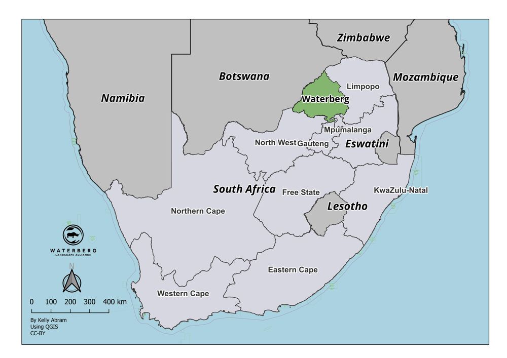
South Africa Map
waterberg location
DOWNLOAD DOCUMENT
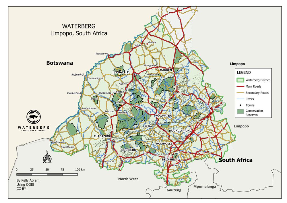
Waterberg Map
Conservation Reserves
DOWNLOAD DOCUMENT
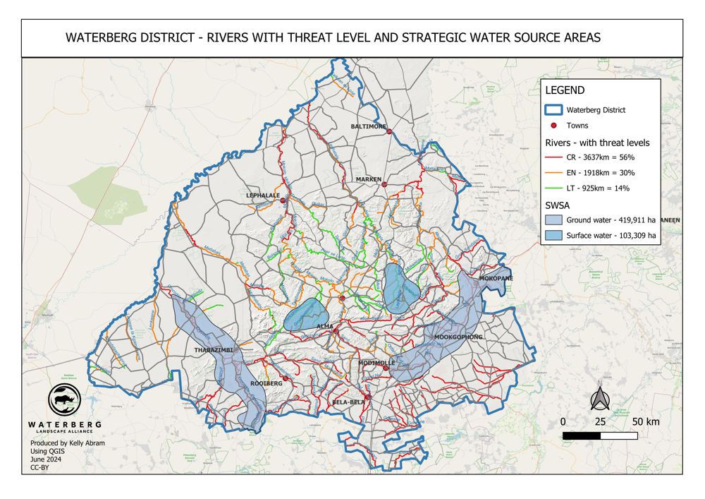
Waterberg Map
Threatened rivers & strategic water sources
DOWNLOAD DOCUMENT
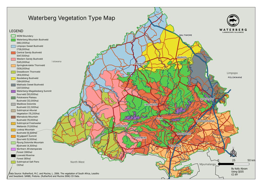
Waterberg Map
Vegetation Type Map
DOWNLOAD DOCUMENT