BUILDING A RESILIENT AND INTEGRATED GREATER NETWORK
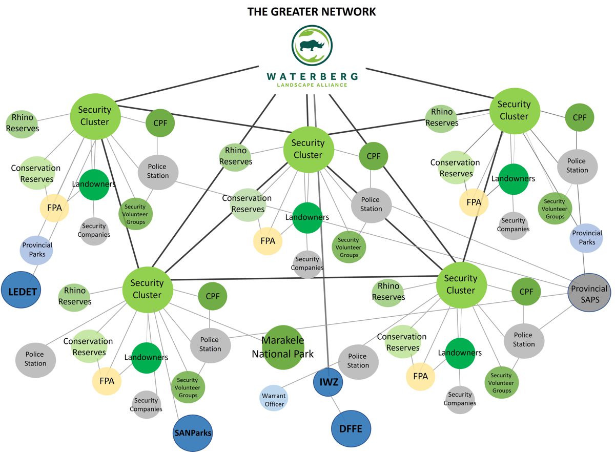
Assisted in the establishment and expanded security stakeholders networks cover more than 4 million hectares, across eight security clusters, protecting people and wildlife at scale.
Fostered cooperation among South African Police Service (SAPS), SAPS – Endangered Species Unit (ESU), Community Policing Forums (CPFs), landowners, government, security stakeholders and NGOs to strengthen regional security.
Initiated the Waterberg Security Initiative (WSI) community cluster now independent and financially self-sustaining, covering >320,000 hectares with over 100 members.
Collaborative risk monitoring and threat analysis across the Greater Waterberg Network, supporting informed decision-making and proactive mitigation measures at landscape scale.
STRATEGIC FUNDRAISING AND RESOURCE ALLOCATION
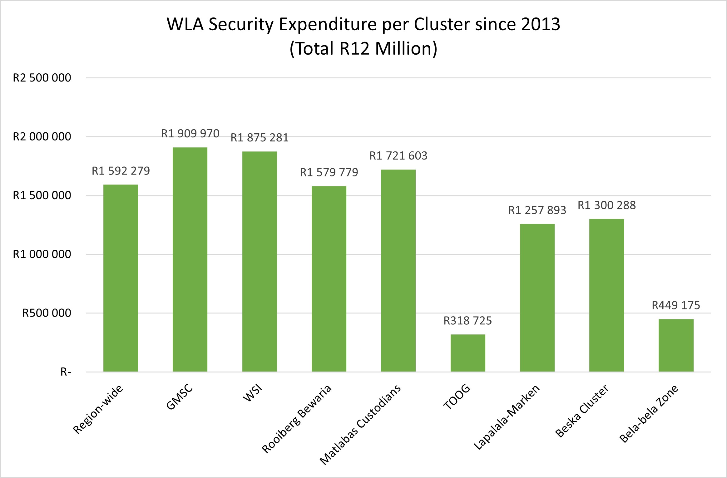
Raised over R20 million to date.
More than R12 million spent directly on regional security, technology upgrades, training, and infrastructure.
Funds strategically allocated to benefit the broader community rather than individual reserves (covering more than 4 millions ha).
Supported major security projects, rhino poaching awareness initiatives, and information-sharing efforts.
Funds also spent on conservation and community projects, such as support to African Wild Dogs, Biodiversity Stewardship awareness, Vaalwater Community Nurse, the Waterberg Living Museum, rhino visits for rural schools, school and community vegetable gardens, and Tutudesks for schools etc.
FINANCIAL SUPPORT TO CLUSTERS AND THE GREATER NETWORK
Provided financial support across the 4.5 million-hectare Greater Waterberg landscape, strengthening coordinated conservation and security efforts at scale.
Supported all eight operational clusters within the network, reinforcing local capacity, collaboration, and rapid response capability.
Assisted the South African Police Service (SAPS) Endangered Species Unit through the provision of critical equipment and vehicle support.
Invested in major security technology initiatives to enhance surveillance, intelligence gathering, and proactive threat mitigation.
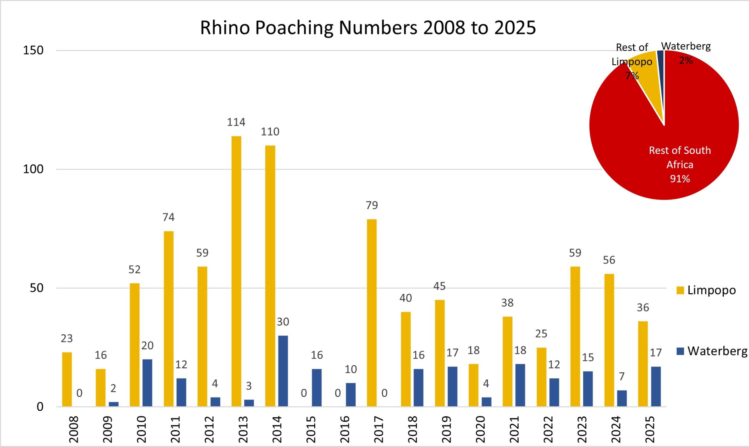
PROACTIVE COORDINATION AGAINST RHINO POACHING
Maintained rhino poaching within the Waterberg at just 2–4% of South Africa’s national total, demonstrating the effectiveness of coordinated, landscape-scale security interventions.
Implemented ongoing risk assessment and threat analysis processes, allowing for early identification of emerging poaching risks and targeted preventative action to protect rhino.
Built trusted collaboration between private landowners, reserve managers, security teams, and law enforcement agencies, reinforcing collective capacity to protect rhino populations.
Active participation in national wildlife security and anti-poaching networks.
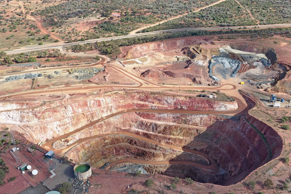
MINING AND DEVELOPMENT OVERSIGHT
Reviewed mining and development applications across the Waterberg, ensuring early identification of potential risks to biodiversity, ecological integrity, and protected landscapes.
Provided technical comments on Environmental Impact Assessments (EIAs) and / or appeal applications, strengthening environmental compliance and decision-making processes.
Engaged proactively with developers, authorities, and affected stakeholders to advocate for avoidance, mitigation, or appropriate redesign of high-risk proposals.
Supported members and landowners in understanding regulatory processes, empowering informed participation in development and land-use planning decisions.
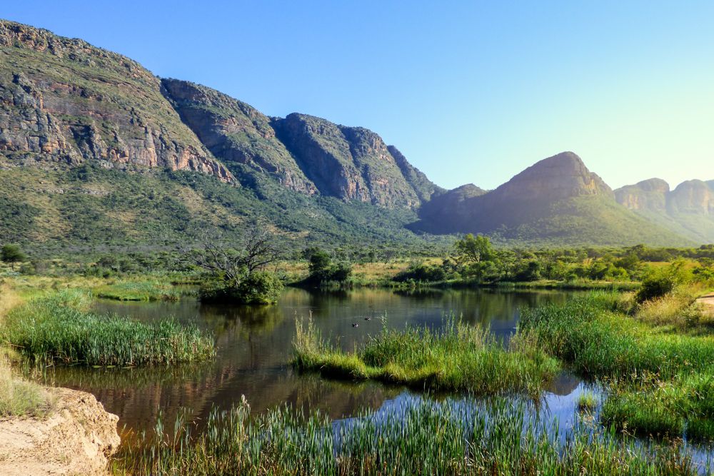
BIODIVERSITY RESOURCES AND SPATIAL PLANNING SUPPORT
Developed practical guidance documents and biodiversity resources to support informed land-use and management decisions by landowners.
Compiled and shared information on threatened species, priority habitats, and conservation status to strengthen biodiversity stewardship across the landscape.
Produced spatial tools and maps to improve understanding of ecological sensitivities, connectivity, and conservation priorities within the Waterberg.
Promoted the Waterberg as a biodiversity hotspot by consolidating and communicating key ecological data, conservation plans, and spatial frameworks.